Będzin is located in Poland, but became part of Greater Germany during the Nazi occupation of Eastern Europe.
To locate Będzin during Europe’s changing borders before, during, and after World War II, or the location of the Kamionka ghetto, consult the interactive and static maps below.
Interactive maps
European Borders before 1939
Maps
European Borders 1939-1944
Includes location of extermination camps
European Borders after 1945
Includes the routes of liberation by Będzin surviving youth
Static maps
Będzin & Surrounding Regions (1939)
Map of Będzin and its surrounding region, located at the borderlands of Greater Germany and Poland before and after 1939.
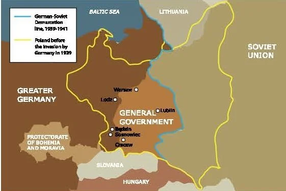
Będzin & Surrounding Regions (1939)
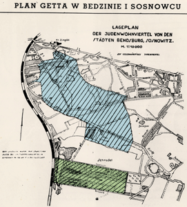
Kamionka Ghetto (1942-1943)
A historical map of Kamionka (light blue), where Jews of Będzin were forced to move, and Srodula/Schrodel (light green), where Sosnowiec’s Jews had been resettled. The Hakoah stadium, where the selection took place on August 12, 1942, was located on the top left corner of the map, at the crossing of a major road and the railway tracks.